
Option in Geographical Information Systems (GIS)
GIS is central to a lot of work in geography, environment, and other fields. Knowing how to understand and apply GIS tools can benefit students in their careers after completing their degrees.
There are three general paths with regard to learning and practicing work with GIS:
Introduction to GIS (GEOG-ERSC 2090H):
Students may take this course to learn the fundamentals of map making, working with digital geographic data, gaining some experience working with ArcGIS, and performing some elementary GIS operations.
- This course requires one or more of first year Geography, ERS, or Biology.
- This course is a required course for all Geography majors.
Students enrolled in GEOG-ERSC 2090H web-based course for the 2021 Winter term (January 11 - April 30, 2021) must visit Computer Requirements for TSE GIS Courses to learn more about the computer requirements and software needed for this course.
Intermediate GIS
Students may expand their knowledge and experience in GIS by taking one or more of several Trent GIS courses (see list below). These courses each have their own prerequisites, and may include GEOG-ERSC 2090H (to ensure some experience with GIS) and math credits (to ensure an understanding of various data analysis techniques). Consult the Academic Calendar for details on these courses, and the Academic Timetable for which of these courses are offered in current and upcoming academic term(s).
- ERSC-GEOG 3010H: Fundamentals of GIS Analysis
- GEOG-ERSC 3020H: Remote Sensing of the Environment
- GEOG-ERSC 4450H: Spatial Modeling with GIS
- opportunities to apply GIS in other courses, such as ERSC-GEOG 4640H, Thesis and Community-Based Research Project courses
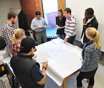
Students conducting GIS work in a lab of ERSC-GEOG 4640H, Watershed Management.
Option in Geographic Information Systems: Intensive GIS at Trent and Fleming College
Students who want more extensive GIS knowledge and experience from their degree may complete the Option in Geographic Information Systems joint-program with Fleming College. This is available to students taking an Honours (4-year) degree in any of:
- Archaeology B.A. or B.Sc.
- Environmental and Resource Studies B.A. or Science B.Sc.
- Geography B.A. or B.Sc.
This Option in GIS is more work than a Honours degree alone as students have fewer elective courses.
- Students complete 5 credits in each of their first two years at Trent, then complete 3 semesters of classes at Fleming in their third year, return to complete their remaining 3 credits at Trent in their fourth year.
- Students must successfully complete all three semesters of one of the Fleming Programs above with a minimum 60% grade in all courses to earn the Ontario College Graduate Certificate. These courses count towards their Trent degree as 7 upper-level Trent science credits, 4.5 of which count as 3000-level credits in their major, and 2.5 count as unassigned 3000-level credits.
- For their third year, students may choose between 2 specialist programs: GIS Applications Specialist or GIS Cartographic Specialist.
Students successfully completing this Option in GIS earn more credentials for the extra work. In four years, a successful student will earn:
- a Trent Honours degree in their chosen field of study (from above), with a note on their Trent University transcript indicating the completed Option and
- an Ontario College Graduate Certificate in their chosen Fleming College GIS program
Program Requirements
At least 10.0 university credits, including:
- the 1000-level introductory course plus at least 2.0 additional credits in the student's major (one of Geography, Environmental and Resource Science or Studies, or Archaeology)
- the course GEOG-ERSC 2090H (Introduction to Geographical Information Systems)
- at least 1.0 credits from Computing & Information Systems
In addition, Geography majors should have successfully completed GEOG-BIOL-ERSC 2080H (Natural Science Statistics).
Interested students are encouraged to acquire as much computer programming experience as possible beyond the required courses, in order to equip themselves for the Technical Issues component of the Fleming year. Experience in algorithm design with C++ programming and Visual Basic languages would be an asset.
Courses
Students will take courses that meet the requirements of their Trent degree; please see courses offered by the respective academic unit via the Academic Calendar, Academic Timetable, or the department's website.
Applying
Applicants should consult with the Director/ Chair of their academic program at Trent:
- Archaeology
- Environmental and Resource Science/ Studies or Geography, contact the Trent School of the Environment.
It is recommended that students make contact in their first year or early in second year, because completing the Emphasis in GIS requires some planning with respect to courses. Completed application forms must be submitted to the Director of the Trent School of the Environment by January 20th of the student's second year.
Application does not guarantee admission. Selection is based on the courses and cumulative averages to date, including mid-year grades in second year. Students are informed of the results of their application prior to the opening of registration at Trent in spring. Successful applicants receive a letter of acceptance and contact information for the Fleming College year of the Program. Admitted students must also apply online to the Ontario College Application Service.
Fees
For the third year of the program, tuition is paid to Fleming College. For the other three years you will pay tuition to Trent. There is also fee to the Ontario College Application Service.
An example of a map created via GIS for use by the Trent Nature Areas and Physical Resources, as preparations are made for the arrival of the invasive species Emerald Ash Borer.