The Lock 22 Nature Area offers trails, views of the Otonabee River and the Robert G. Lake Hydroelectric Generating Station. It connects up with trails that cross the Otonabee River at Trent Canal Lock 22 and the Lady Eaton Drumlin.
Maps
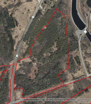
A) Satellite Imagery
1. Created in ArcGIS Pro (click to view full size). The read outline delineates the nature area boundary. This nature area has undergone a couple of significant changes over the years, most recently with the construction of the Robert Lake Hydroelectric Power Station. From the wintertime image you can see this area contains a large number of coniferous species. It also drains through a wetland to the east eventually into the Otonabee River.
2. Via Google Maps (shows latest satellite image available via Google Maps; will not show boundary).
Location and Use
The Lock 22 Nature Area is located between Highway 29 (to the west), the Otonabee River (to the east),and West Bank Drive (to the south). It offers trails that connect up other trails as part of a larger trail network in the area, and includes the forest on the north side of West Bank Drive.
Trails, Access, and Points of Interest
This Nature Area includes trails up the west side of the Otonabee River to Trent Canal Lock 22 (Nassau Mills), where one can cross the Otonabee river and either return south to Trent University on the east bank, or walk over to the Rotary Greenway Trail and continue north to Lakefield or south to Peterborough. It also includes trails that pass through the the Robert G. Lake Hydroelectric Generating Station.
Physical Description
The area was significantly transformed by the construction of the Robert G. Lake Hydroelectric Generating Station. The station construction included the building of a canal that stretches from Lock 23 down past lock 22 (to take advantage of the larger water level difference), which has isolated an area along the Otonabee river from areas further away from the bank, creating an island of sorts. Forest and wetland still exist in this area around the canal, and the trail up the west side of the Otonabee River passes over the generating station, where one can see the canal on the west side and the Otonabee River on the east side.
This has changed the drainage pattern somewhat from a wetland just north of West Bank Drive, which drains into the Otonabee River south of the generating station.
Ecosystems and Species
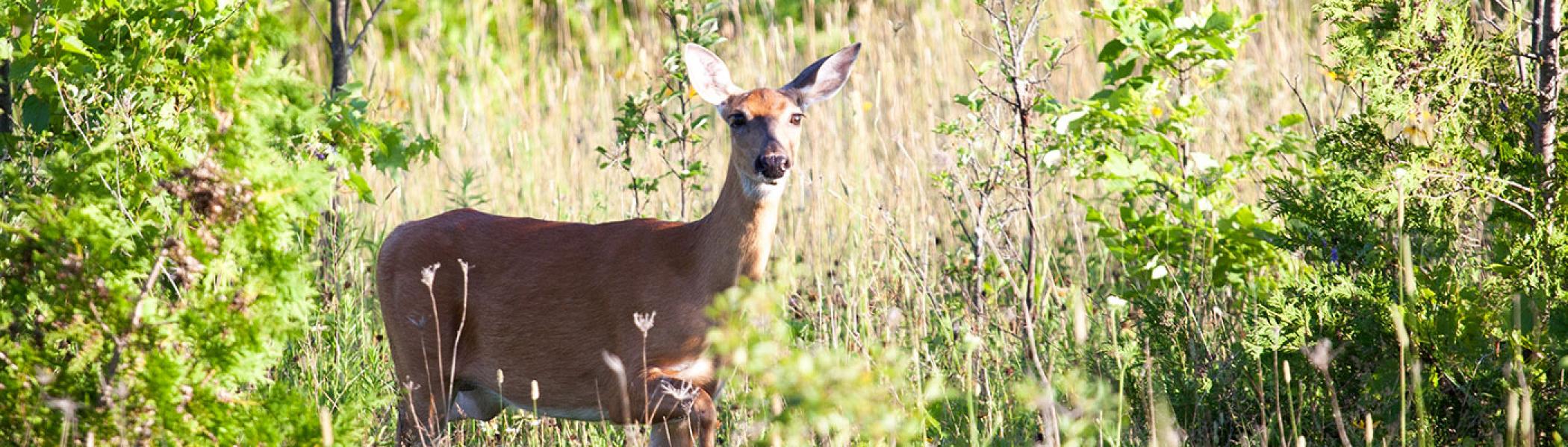
Although the station construction removed much of the original Maple-Beech forest, remnants of this forest still reside here, and they do put on a show in autumn. As well, the wetland just north of West Bank Drive includes an Osprey nest which is occupied most years, and a marsh north of north of Lock 22 right on the Otonabee west bank offers several different species.
Environmental Concerns
The loss of Ash to the Emerald Ash borer will affect the forest composition and future successional direction in this Nature Area, and this area is also exposed to traffic from both Highway 29 and West Bank Drive. As well,
Nature Area History
In 1994 this region was home to two Nature Areas: the Lock 22 Maple-Beech Woods (including the area to the west of Lock 22), and the Horsetail-Fern Meadow Wetland (included the wetland just east of Highway 29 and its flow east to the Otonabee River). In 2001 these areas were merged into the Lock 22 Nature Area. Around 2006-7 discussion was had about a proposal to build a hydroelectric generating station on the Otonabee River. While it offered the opportunity to generate "clean" energy (at least relative to fossil fuels), the proposed development of this station would remove a substantial amount of the Maple-Beech forest located to the west of Lock 22. After some discussion, including issues such as how to preserve the wetlands and trails in the area, the Robert G. Lake Hydroelectric Generating Station was built starting in April 2008 and finished in December 2009. Trent leases the land on which the generating station is built, but has no involvement in the construction or management of the power station.
More Updates to Come!
We are working at posting maps and physical descriptions of the Trent University Nature Areas. Stay tuned for updates!