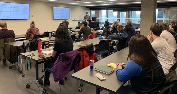
GIS Research Day is hosted annually by MaDGIC. The purpose of this event is to showcase what is made possible by applying GIS and related spatial technologies and techniques in your research. Students and researchers from all disciplines share their practices and discuss the importance of linking space and place to their work.
This event is held each year in November during the global Geography Awareness Week. Details for the 2024 event will be posted here in October.
Past GIS Research Day Events
Check out our speakers and topics from past events.
SPEAKER SCHEDULE: Wednesday November 15, 2023
| 9:00 | Hot beverages and a warm welcome from Trent University Library & Archives | ||
| 9:15 | James Bacon | Anthropology | LiDAR, the all-seeing eye of archaeological survey |
| 9:30 | Keelan McHugh | Environmental & Life Sciences | A land-use regression analysis of tropospheric ozone in Ireland |
| 9:45 | Trevor Maclaurin | Environmental & Life Sciences | Impacts of vegetation encroachment on American Oystercatcher nest site selection and reproductive success |
| 9:50 | Lyn Brown | Environmental & Life Sciences | Foraging movements of American Oystercatchers |
| 10:15 | Christine Brown | Ancient Greek & Roman Studies | Ancient land division and the Bonifica of southern Italy |
| 10:25 | Break & GIS Day Cake! | ||
| 10:55 | Christie Lavallée | Environmental & Life Sciences | Conservation value accounting: The importance of the Canadian boreal forest biome |
| 11:10 | Nathan Lapp | Computer Science | Leveraging GIS to create 3D worlds |
| 11:15 | Craig Onafrychuk | Ontario Elevation Mapping Program | Digital elevation data to support GIS research |
| 11:40 | Owen Lucas | Bioenvironmental Monitoring & Assessment | Mapping Caribou Lichen in the Hudson Bay Lowlands: Developing a novel application for UAV classification and upscaling |
| 11:55 | Greg Melvin | Environmental & Life Sciences | Muskrats in marshes: Living on the edge |
| 12:10 |
Ali Giroux and Gillian Johnson |
Facilities Management | GIS: The unsung hero in land stewardship |
| 12:35 | Tracy Sallaway | Maps, Data & Government Information Centre | Trent Esri Scholarship 2024 |
| 12:40 | Abdirahman Ahmed |
Environmental & Life Sciences | Time series analysis of forest cover change in southern Somalia and identifying possible causes |
SpeaKer SCHEDULE: THURSDAY NOVEMBER 17, 2022
| Time | Speaker | Affiliation | Title |
| 9:00 | Library | Coffee & Welcome | |
| 9:15 | Roshelle Chan | Environmental & Life Sciences | Automating the characterization of watershed land use across southern Ontario |
| 9:25 | Una Jermilova | Environmental & Life Sciences | Mercury in the Mackenzie River Basin: ArcGIS Mapping to model release via soil erosion and other potential sources Link to talk |
| 9:40 | Dr Roger Picton | Trent School of the Environment | Using StoryMaps to cultivate a "geographic imagination" Link to Talk |
| 9:55 | Dr Nolan Pearce | Biology | Constructing the 3D distribution of limnological variables within three interconnected lakes in the Kawarthas Link to talk |
| 10:10 | Dr James Conolly | Anthropology | Archaeology, lake evolution and shoreline history in the Kawartha Lakes |
| 10:30 | BREAK | ||
| 11:00 | Shilah LeFeuvre | Environmental & Life Sciences | Two Eyed Seeing: Weaving knowledge systems to understand the genetics, distribution and behaviour of Eastern wolves (Canis lycaon) in collaboration with Magnetawan First Nation, Shawanaga FIrst Nation, and Wiikwemkoong Unceded Territory |
| 11:15 | Dr Raul Ponce-Hernandez | Trent School of the Environment | GIS in the age of big data, artificial intelligence, automation and climate change: the leap forward for geomatics |
| 11:35 | Lyn Brown | Environmental & Life Sciences | Using Field Maps to examine foraging habitat quality for a coastal shorebird Link to talk |
| 11:50 | Dr Kaitlyn Fleming | Trent School of the Environment | Using ArcGIS to determine the effect of land-use on benthic macroinvertebrate community composition Link to talk |
| 12:05 | Kayla Martin | Environmental & Life Sciences | Mapping wild turkey roosting sites Link to talk |
| 12:20 | Kiefer Thalen | Biology, BEMA | Addressing citizen science through a priori sample design |
| 12:35 | Geoff Andrews | MaDGIC (Alumni) | Two roads diverged on a map ... |
| 12:50 | Justin Barker | MaDGIC | Species distribution models: Administrative Boundary centroid occurrences require careful interpretation Link to talk |