Ward Hunt Ice Shelf
1) The Ward Hunt Ice Shelf break-up animated using cloud-free MODIS images. The animation shows an area that is approximately 75 km wide. NB: The events displayed here were already widely reported at the end of July. MODIS image from the Rapid Response Project at NASA/GSFC. Animation courtesy Derek Mueller, Trent University.
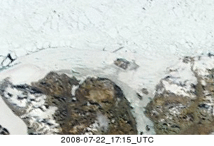
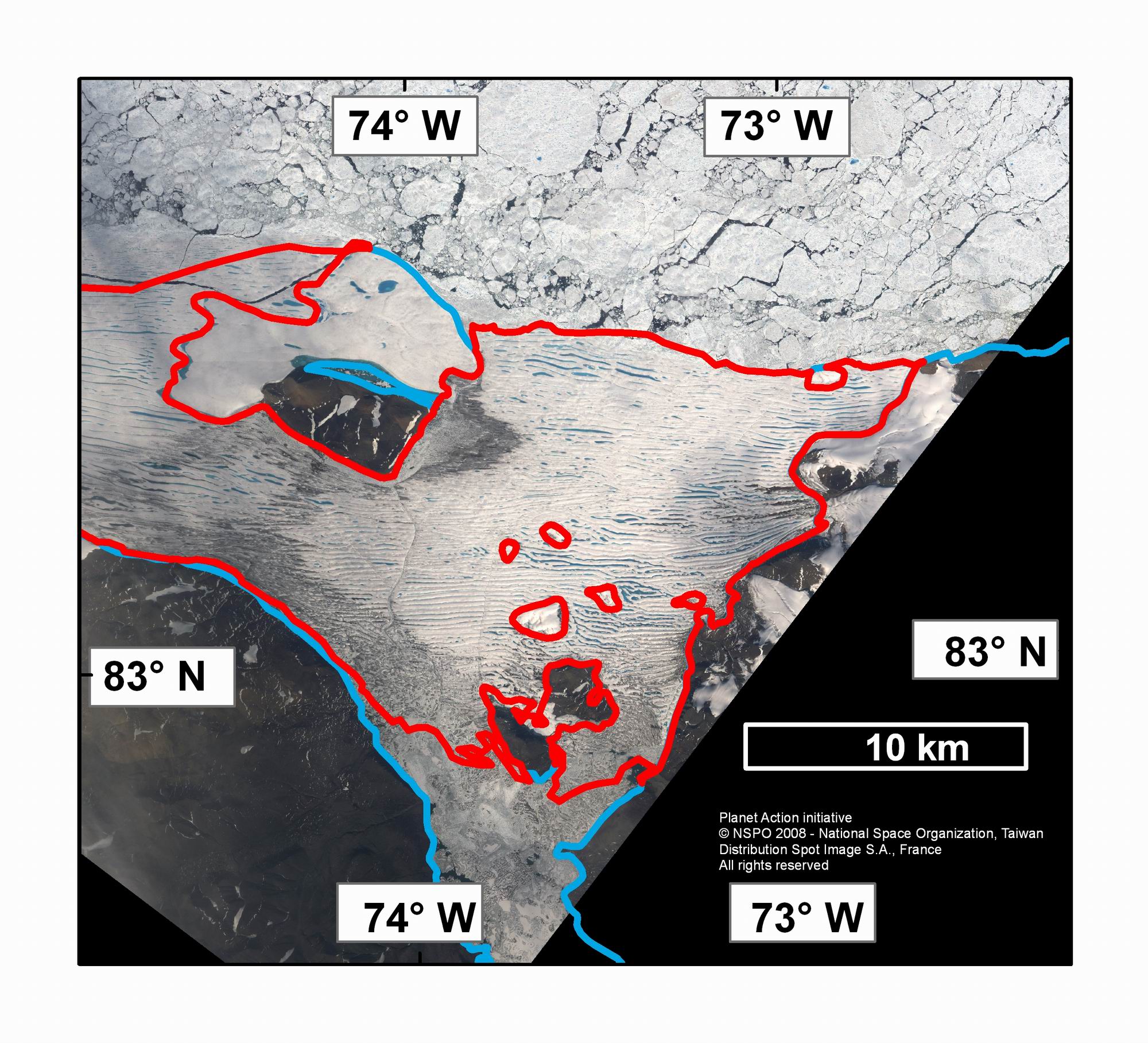
2) A FORMOSAT-2 image of the eastern Ward Hunt Ice Shelf (2006 extent outlined in red) on July 17, 2008. Note the piece of ice shelf and multiyear landfast ice detached off to the north of Ward Hunt Island. Image courtesy of Pax Arctica and the Planet Action Initiative, © NSPO 2008 - National Space Organization, Taiwan,
Distribution Spot Image S.A., France,
All rights reserved.
High Resolution Version
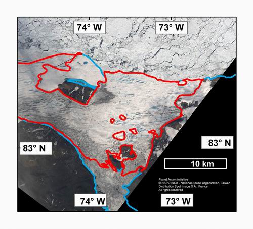
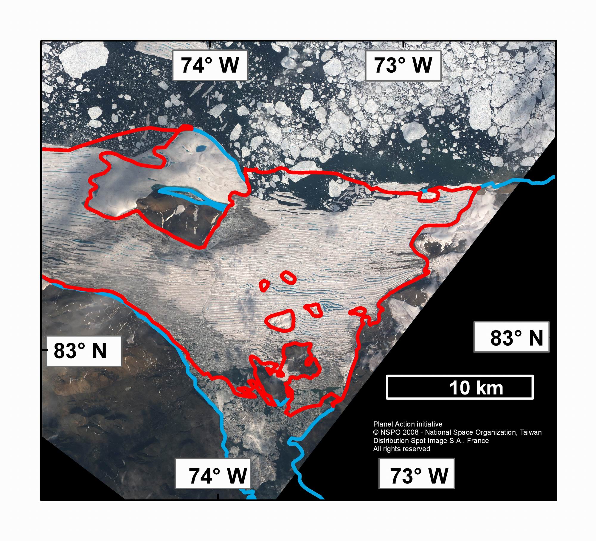
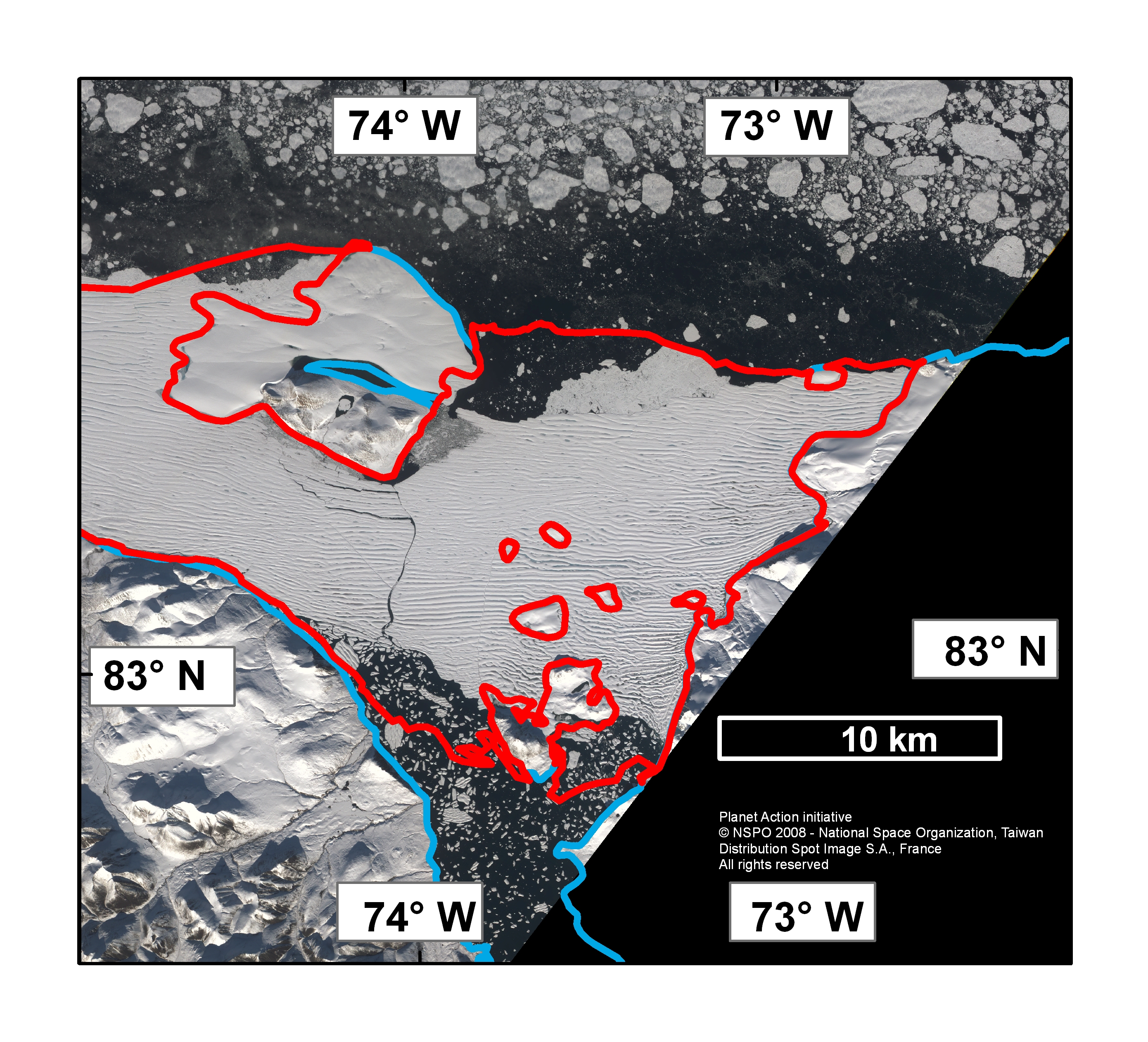
3) A FORMOSAT-2 image of the eastern Ward Hunt Ice Shelf (2006 extent outlined in red) on July 27, 2008. A 20 km2 area of the ice shelf has calved to the east of Ward Hunt Island. NB: These calving events were widely reported at the end of July. Image courtesy of Pax Arctica and the Planet Action Initiative, © NSPO 2008 - National Space Organization, Taiwan,
Distribution Spot Image S.A., France,
All rights reserved.
High Resolution Version
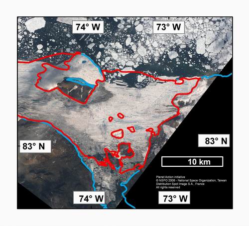
4) A FORMOSAT-2 image of the eastern Ward Hunt Ice Shelf (2006 extent outlined in red) on August 18, 2008. Note the new east-west cracks to the south of Ward Hunt Island and further loss at both the northern and southern calving fronts. New snow covers the ice shelf and some sea ice can be seen stuck to the northern edge of the ice shelf. Image courtesy of Pax Arctica and the Planet Action Initiative, © NSPO 2008 - National Space Organization, Taiwan,
Distribution Spot Image S.A., France,
All rights reserved.
High Resolution Version
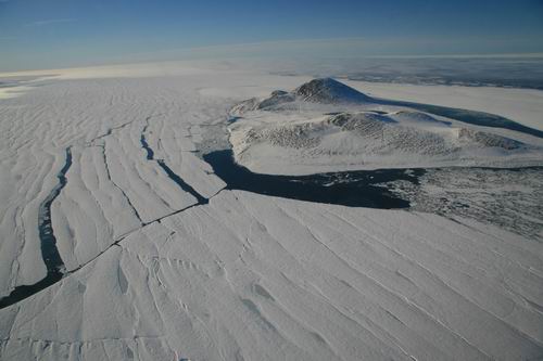
5) Ward Hunt Island and the crumbling Ward Hunt Ice Shelf to its south. Note the new cracks running to the west and calving to the north east of Ward Hunt Island. Photo courtesy of Denis Sarrazin, ArcticNet/Centre d'Etudes Nordiques.
High Resolution Version

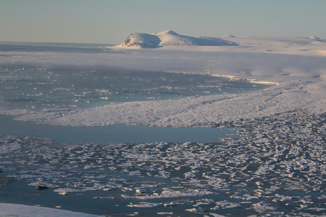
6) The eastern portion of the Ward Hunt Ice Shelf with Cape Albert Edward in the background. Photo taken July 21, 2008 before widely reported calving of roughly 20 km2 of the ice shelf. © Luc Hardy/SAGAX, all rights reserved. Pax Arctica blog: www.sagaxexpeditions.com/blog/blog.html
High Resolution Version
7) The eastern portion of the Ward Hunt Ice Shelf with Cape Albert Edward in the background. Photo taken in mid-August, 2008. Compare with the photo above. Photo courtesy of Denis Sarrazin, ArcticNet/Centre d'Etudes Nordiques.
High Resolution Version
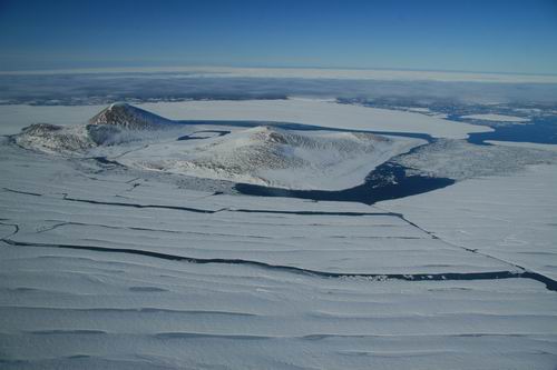
8) New cracks running into the western half of the Ward Hunt Ice Shelf. Photo courtesy of Denis Sarrazin, ArcticNet/Centre d'Etudes Nordiques.
High Resolution Version
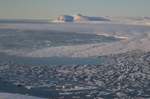
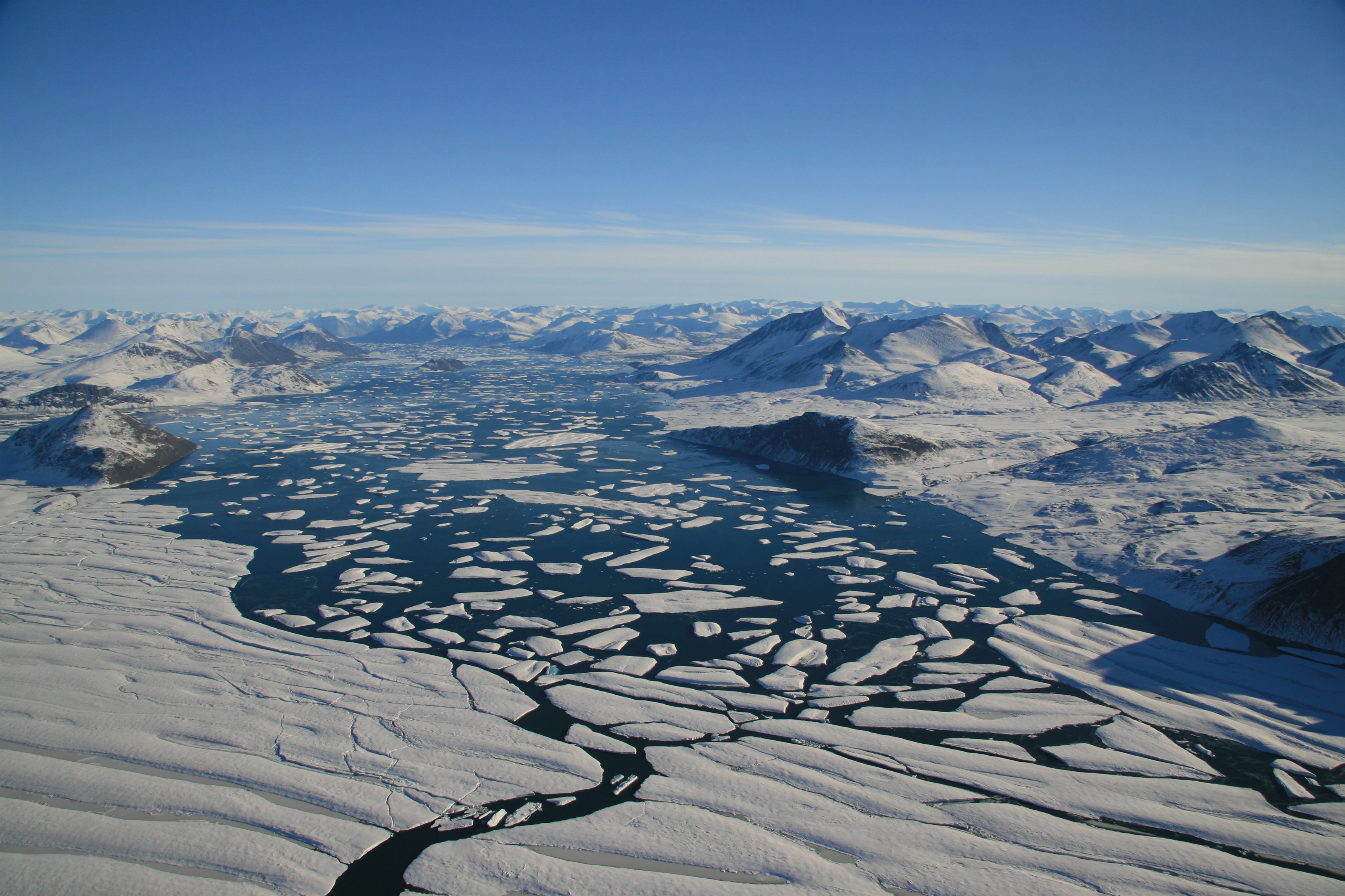
9) Calving of the Ward Hunt Ice Shelf into Disraeli Fiord during August 2008. Photo courtesy of Denis Sarrazin, ArcticNet/Centre d'Etudes Nordiques.
High Resolution Version
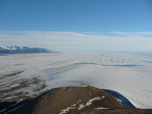
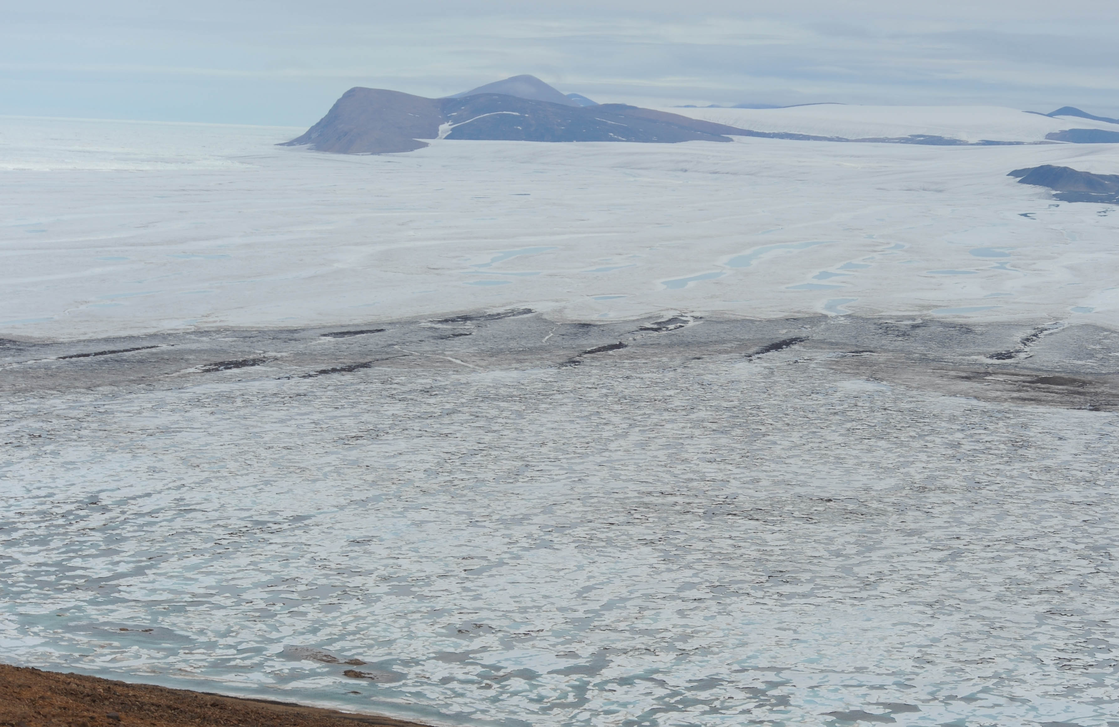
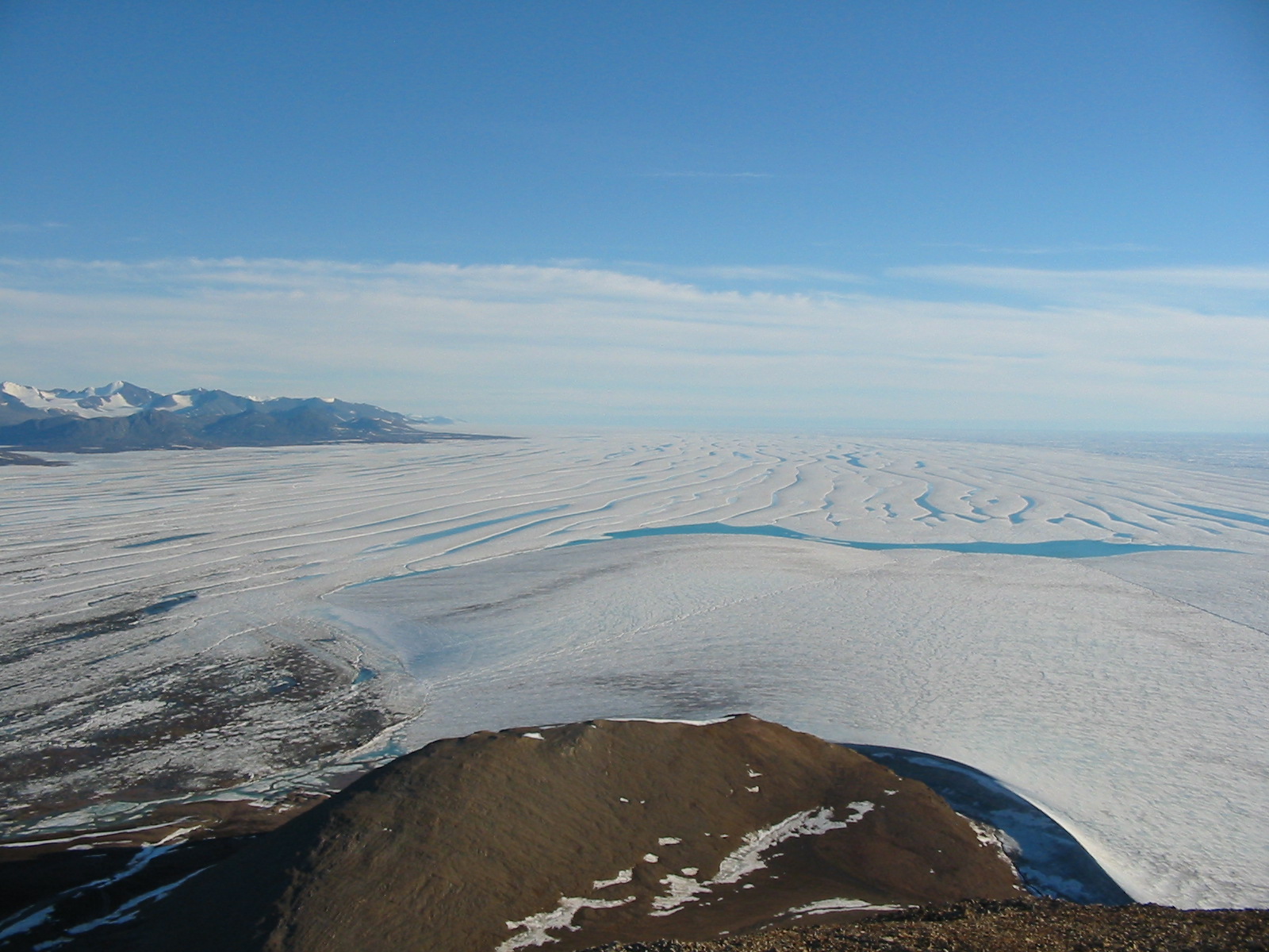
10) The western Ward Hunt Ice Shelf from the top of Walker Hill (430 m) on Ward Hunt Island during summer 2003. This portion of the ice shelf is still relatively intact. Photo courtesy of Derek Mueller, Trent University.
High Resolution Version
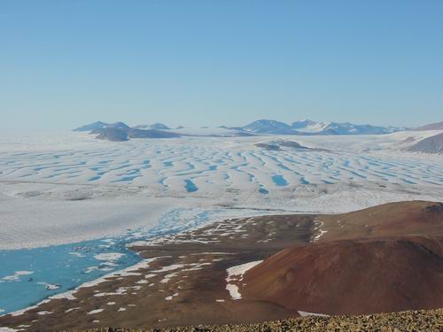
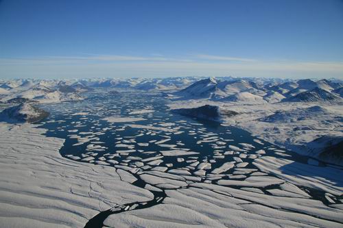
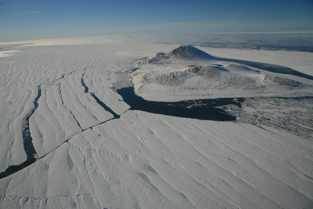
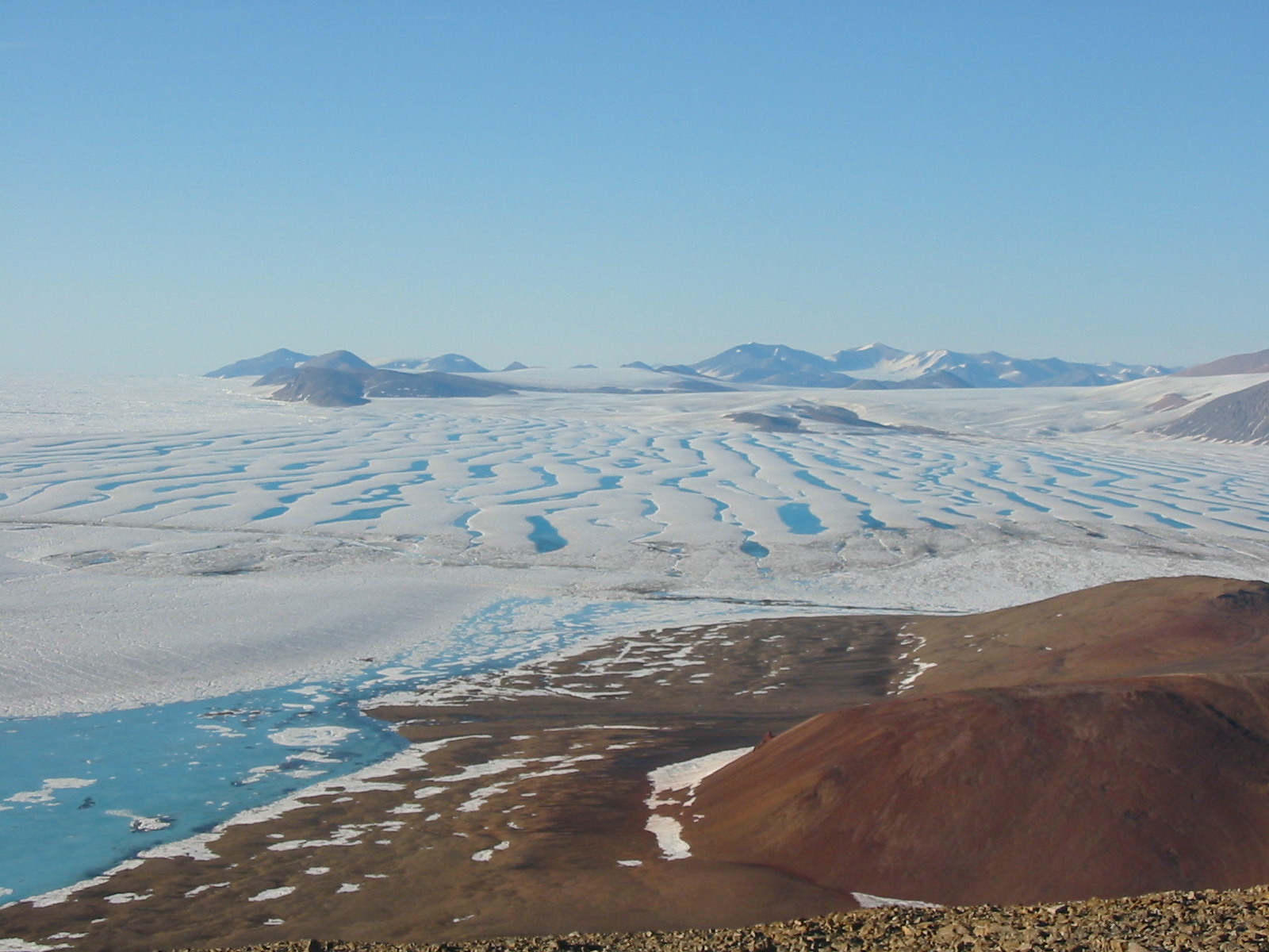
11) The eastern Ward Hunt Ice Shelf from the top of Walker Hill (430 m) on Ward Hunt Island during summer 2003. Much of the ice in this photo is broken up. The ice to the far left of the image has calved away. Photo courtesy of Derek Mueller, Trent University.
High Resolution Version