1) The Markham Ice Shelf break-up animated using cloud-free MODIS images. The animation shows an area that is approximately 40 km wide. MODIS image from the Rapid Response Project at NASA/GSFC. Animation courtesy Derek Mueller, Trent University.
1) The Markham Ice Shelf break-up animated using cloud-free MODIS images. The animation shows an area that is approximately 40 km wide. MODIS image from the Rapid Response Project at NASA/GSFC. Animation courtesy Derek Mueller, Trent University.

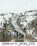
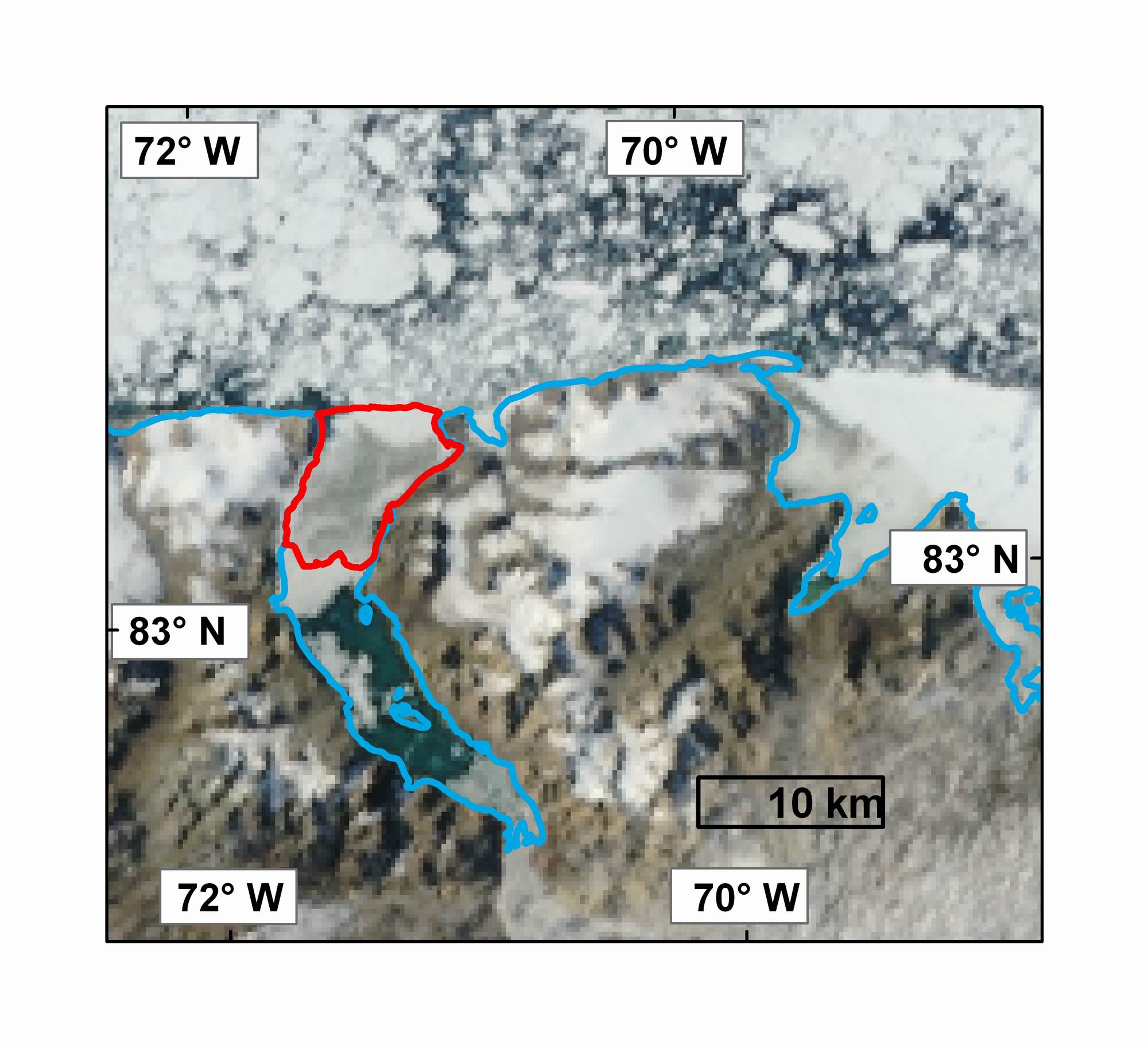
2) A MODIS image of the Markham Ice Shelf (2006 extent outlined in red) on July 28, 2008 prior to calving. Note the open water in Markham Fiord south of the ice shelf. MODIS image from the Rapid Response Project at NASA/GSFC. Map courtesy Derek Mueller, Trent University.
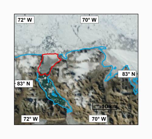
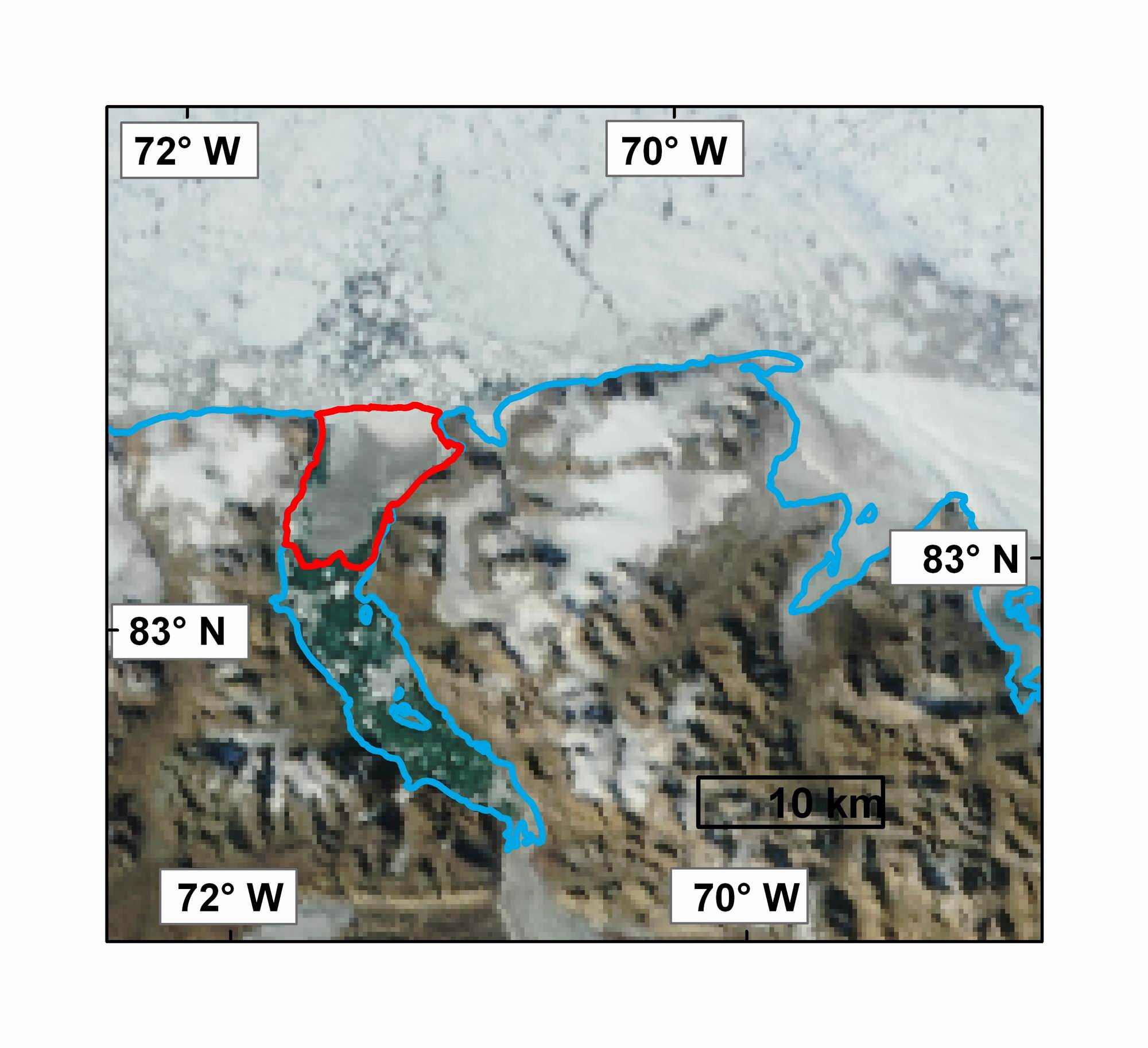
3) A MODIS image of the Markham Ice Shelf (2006 extent outlined in red) on August 6, 2008 starting to disintegrate. MODIS image from the Rapid Response Project at NASA/GSFC. Map courtesy Derek Mueller, Trent University.
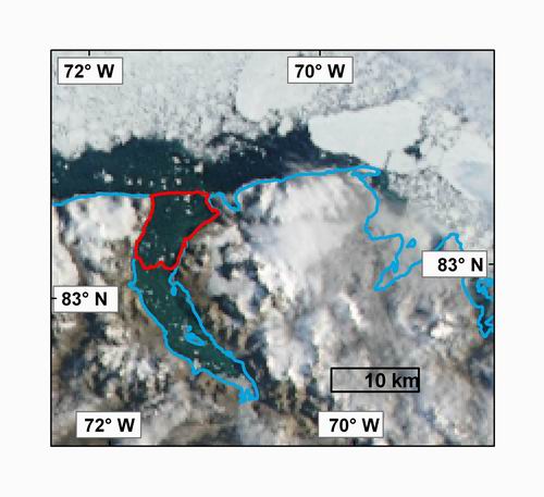
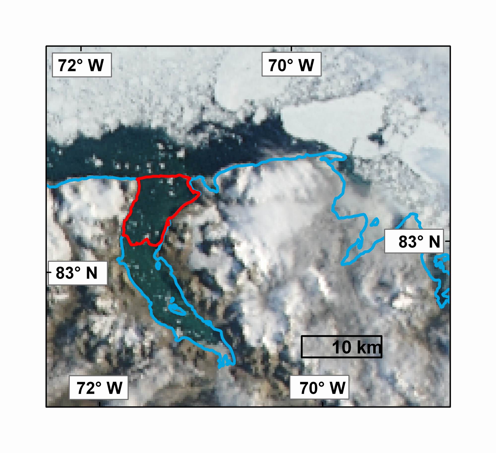
4) A MODIS image of Markham Fiord on August 12, 2008 following the loss of the Markham Ice Shelf (2006 extent outlined in red). MODIS image from the Rapid Response Project at NASA/GSFC. Map courtesy Derek Mueller, Trent University.
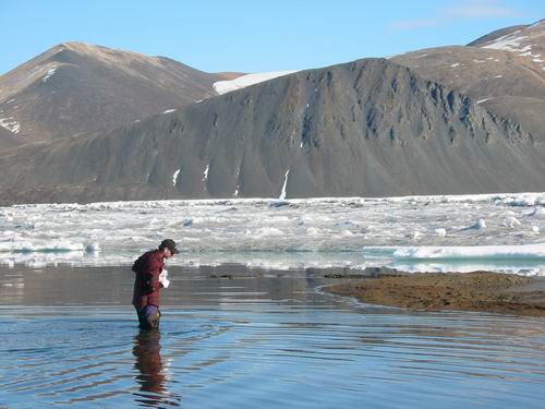
5) Dr. Derek Mueller walks into a shallow meltwater lake to sample the microbial communities that inhabited the surface of the Markham Ice Shelf in July 2002.
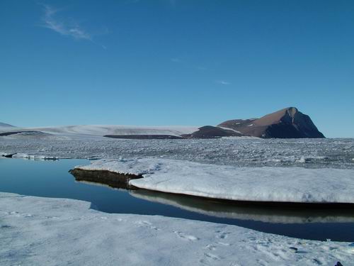
6) A melt water lake on the surface of the Markham Ice Shelf with Cape Nares in the background (August 2005). Photo courtesy of Denis Sarrazin, Laval University.

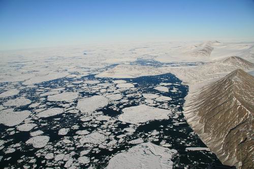
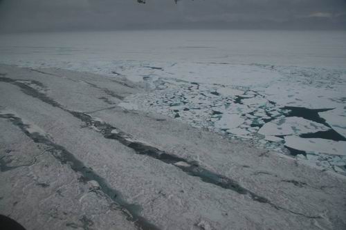
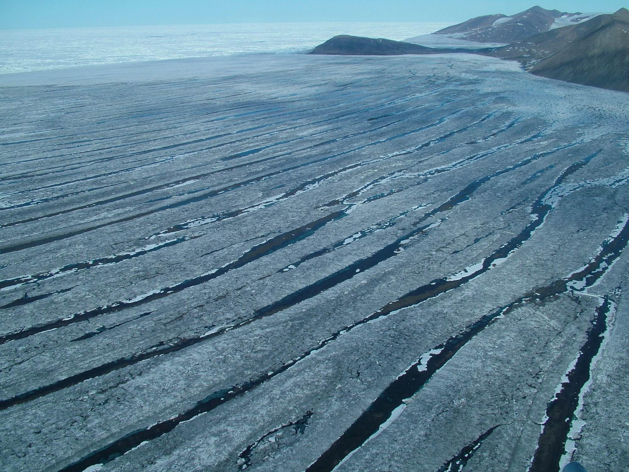
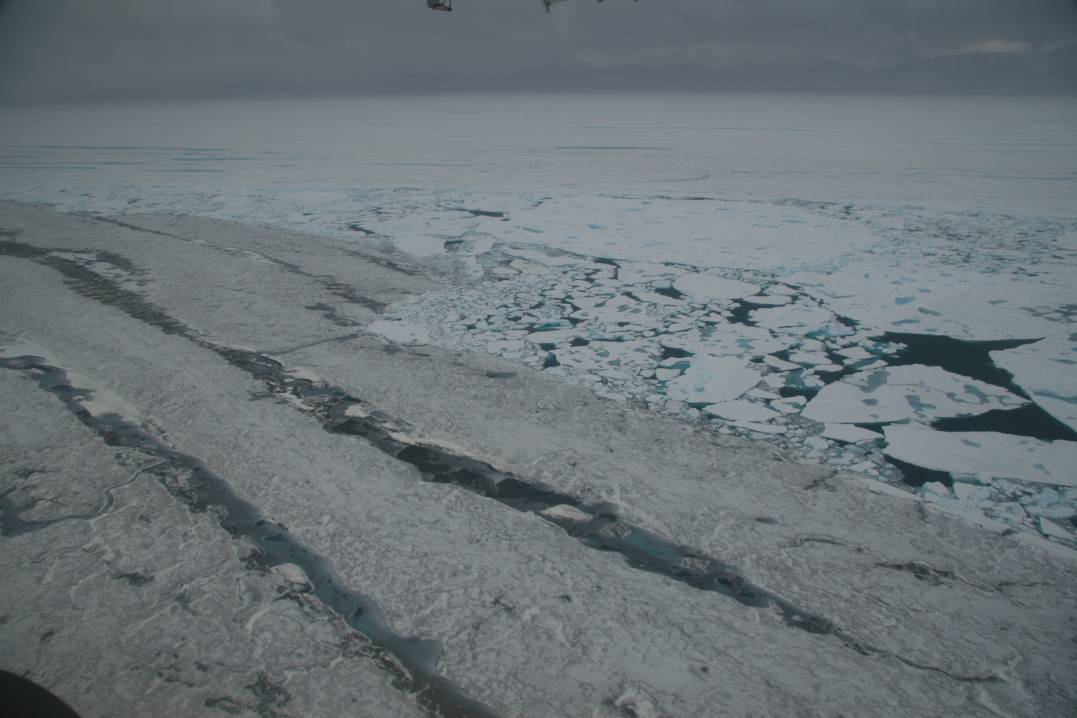
7) Long melt water lakes which contain microbial life on the Markham Ice Shelf viewed from a helicopter in August 2005. Photo courtesy of Denis Sarrazin, Laval University.
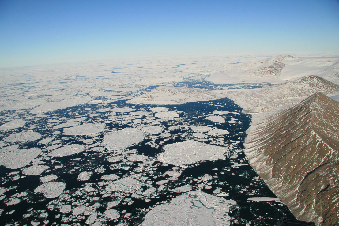
8) Markham Fiord in August 2008 after the Markham Ice Shelf broke away. Compare with the photograph above. Photo courtesy of Denis Sarrazin, Laval University.
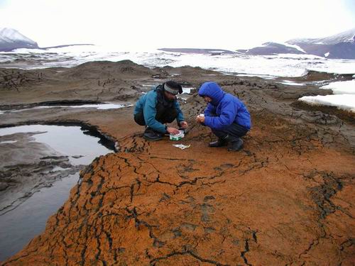
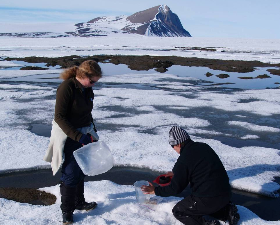
9) Dr. Milla Rautio and Dr. Derek Mueller sample microbial pigments on the Markham Ice Shelf in August 2003. The algae that live on these ice shelves contain a variety of sunscreen and carotenoid pigments to cope with their stressful environment. Photo courtesy of Warwick Vincent, Laval University.

10) Scientists sample microbial communities that live on the surface of the Markham Ice Shelf in July 2007. The ecology of the Markham Ice Shelf is part of an International Polar Year Project (www.cen.ulaval.ca/merge/). Photo courtesy of Warwick Vincent, Laval University.
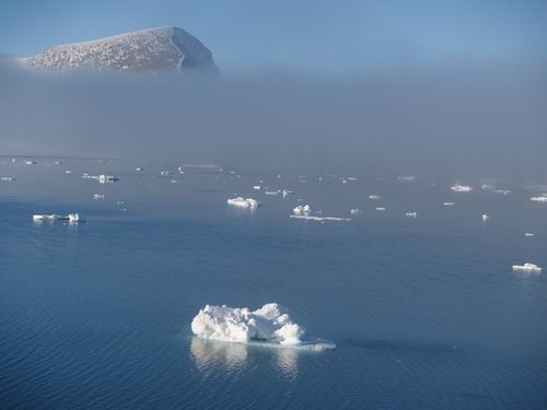
11) Markham Fiord in August 2008 after the Markham Ice Shelf broke away. Compare with the photograph above. Photo courtesy of Warwick Vincent, Laval University.
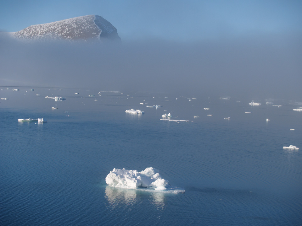
12) One of several ice islands that formed when the Markham Ice Shelf disintegrated. This ice island is 3.8 km long by 1.5 km wide. Photo courtesy of Warwick Vincent, Laval University.

13) The ice island pictured above as it drifts westward past the Ward Hunt Ice Shelf. Formosat-2 image courtesy of Pax Arctica and the Planet Action Initiative, © NSPO 2008 - National Space Organization, Taiwan, Distribution Spot Image S.A., France, All rights reserved.